|
A guide to Mountains and Hills in
Scotland with Links, Images and
Reviews.
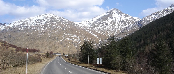
Hill walking in Scotland is an
extremely popular leisure activity with
locals and visitors from around the
world. There are 283 mountains above
3,000 feet known as Munros, over 4,000
people have now claimed to have climbed
them all. Below is the 3,316ft Beinn Ime
by Arrochar village. 
There are 221 hills/mountains between
2,500 & 3,000ft known as Corbetts,
and about 1,000 hills about 2,000ft. Most
have fairly safe walks to the top and can
be completed to the top and back between
3 and 8 hours. The highest Ben Nevis is
4,408 feet.
The links below take you to maps, the
map links lead to information and
multiple images of hikes/climbs.
The images and info are normally under
Walk Reports. When using the maps, click
on the red marker for a mountain, then on
the mountain name to get to the walk
reports for that mountain with info and
multiple images.
A list of Scottish Mountains by most
climbed with photos: View
List.
A click on map showing all the Munros,
above 3,000 ft, with images: View
Map.
A click on map showing the Corbetts
2,500 - 3,000 ft, with images: View
Map.
A click on map showing the Grahams
2,000 - 2,500 ft, with images: View
Map.
A click on map showing the Marilyns
sub 2,000 ft, with images: View
Map.
The only mountain summit that cannot
be hiked to, has to be climbed, is
Sgurr Dearg, at 3,235 ft, on
the Isle of Sky: View Info
& Images.
Photo tours of mountains and hills up
to 3,700 ft in Central Scotland: View Page.
Photo tours of mountains up to 4,408
ft in the Highlands of Scotland: View Page.
Photo tours of mountains and hills up
to 2,800 ft in Southern Scotland:
View
Page.
Photo tours of mountians up to 3,200
ft in Cumbria northwest England: View
Page.
Mountains in Scotland, England &
Wales hand picked not to be missed:
View Page.
Things to look out for:
Clouds rolling in can make the descent
tricky so pay attention to the track you
followed up so you can backtrack to lower
ground. An Ordinance
Survey Map, Compass,
or even a Hand Held
GPS should be taken. If you are on
top of a mountain with no map or compass
when it clouds over, you may soon become
disorientated and not know which way is
north, south, east or west. If this
happens, you are supposed to wait until
the cloud clears.
Snow and Ice conditions should only be
tackled with the correct equipment and
know how to use it, such as crampons and
an ice axe. Knowing how to use an ice axe
to stop a slide, can mean the difference
between stopping, and sliding over deadly
cliffs. Video.
Overhangs of Ice and Snow can break
off when you stand on them, so be careful
on ridges and summits with overhangs, as
there may be no rock under the ice and
snow.
Adders are venomous snakes, up to 2
feet in length, found in the UK from
March to October, they hibernate
underground in winter. These are the only
poisonous snakes in the UK, recognized by
a dark zig zag pattern down their back.
They vary in colour from the most common
brown to reddish, grey and black. They
are not normaly aggressive, and it seems
nobody has died from an adder bite for
over 20 years. Most people bitten by
adders have normally been tying to handle
them. Hiking boots with thick socks,
gaiters or walking trousers are normally
enough to prevent a bite should you tread
on one. I looked for adders while hiking
over 100 hills in 6 months to get photos,
and only saw one. It soon disappeared
down behind a rock, so did not manage to
get a photo. It is not advised to sit in
long grass on the hills or mountains.
More
Information & Images.
|
