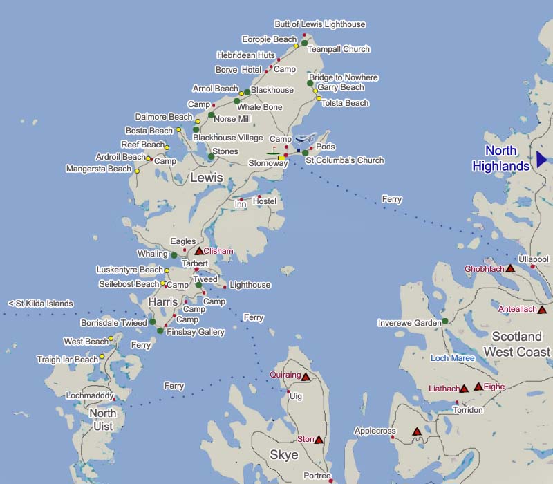
Isle of Lewis Click on Map |
 |
|
An Interactive Click On Map of the Isle of Lewis and Harris showing mountain, activities, towns and top attractions. Click on the towns for information on that town and accommodation, green dots are attractions, yellow dots are beaches, triangles hills/mountains. |
This Map shows the main mountain on Harris. For
all Mountains, see Use Google Maps on Satellite to view the Beaches, they are amazing with Luskentyre Beach one of the top Beaches in the world. |
 |
|
These Mountains should only be climbed with an Ordinance Survey Map and good knowledge of using a Compass. Try to memorize the Trail up, and take the direction of the Trail with a Compass, so if clouds roll over, you can find your way back down. Some of these Mountains lead out into vast areas of wilderness. |
Snow or Ice Conditions should only be attempted after ice training, and with the correct equipment. Layers of clothing should also be taken as it can get bitterly cold at the top, even in summer, i.e. fleece, gloves, hat and weatherproofs. Drinks and snacks should also be taken. Mobile phones may work from some Mountains, but not all. |
| . | . |